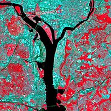
Data, data, and more data! At times it seems we are drowning in data – information overload. But smart data is becoming the future of environmental protection. As satellite imagery and technologies have become super-sophisticated and produce ever better resolution of the earth’s landscapes and activities, we are getting smarter about how to do environmental protection.
Nearly 25 years ago, while completing my Masters work at Duke University, I focused my research on the potential for using various natural resource data bases to populate then very primitive Geographic Information Systems. The concept was simple. Take available data on wildlife populations, sensitive and stressed habitats, water resources, forests and refuges, and developed areas, etc., – all in disparate conditions, locations and formats – and overlay these data points into a single system to create a more data-rich tool for analyzing and prioritizing habitat conservation efforts.
Since then, our technological capabilities have mushroomed and with it ever more valuable information regarding the landscape – data that helps inform and tells an ecological story. Just think of the power at your finger tips with tools like Google Earth and Zillow, and how these tools have increased consumer knowledge and better informed decisions. Well this advancement in environmental platforms is making us smarter in what needs to be protected and how best to protect it. So much to environmental protection, particularly water quality, is directly linked to dynamics of land cover and how land is being used, e.g., forestry, agriculture, developed land, etc.
Joe Dunn, the CEO of the Chesapeake Conservancy (and also a Dukie) – not to be confused with the Chesapeake Bay Foundation or Alliance for the Chesapeake Bay on whose board I serve – is making significant strides in making all this new and improved data publicly available for conservation efforts aimed at restoring the Chesapeake Bay, long impaired by water pollution.
Just this past month, the Chesapeake Bay Program (CBP) announced the completion of the Chesapeake Bay High-resolution Land Cover Project. This initiative is critical to improving our understanding about the natural and human-made features that exist on the landscape of the Bay watershed, such as buildings, tree canopy and water. According to reports, the CBP will use this data set in 2017 as the foundation of its effort to evaluate stakeholder progress toward meeting reduction targets for Bay pollution loads. The Chesapeake Conservancy, a small nonprofit in Annapolis, Maryland, offered an innovative solution to help the CBP improve available data about the Bay watershed. The Chesapeake Conservancy’s Conservation Innovation Center (CIC) spearheaded a partnership with the University of Vermont and Worldview Solutions, Inc. to complete the Chesapeake Bay High-resolution Land Cover Project, one of the largest high-resolution land cover data sets in the nation.
Before this project, the resolution of land cover was 30 meters x 30 meters (about 1/4-acre), and now the resolution has been magnified to 1 meter x 1 meter. The precision means much better resolution to better understand small-scale disturbances to streams and buffers, and more precision to target solutions. All this data is now free to download and completely accessible to the public.
This is good stuff, and I anticipate more good things to come from Dunn’s leadership on this initiative.
Additional details can be found here:
· Chesapeake Bay Restoration to Benefit from Groundbreaking Technology Advancement
· Delaware Online, December 23, 2016: Cutting-edge conservation: Open data protects resources
· The Star Democrat, December 8, 2016: Bay watershed land map rolled out
· PA Environmental Digest, Dec. 6, 2016: High Resolution Landscape Data Now Available In Chesapeake Bay Watershed, Webinars Set

